Unveiling Hidden Dangers: How we utilise LiDAR for UXO Risk Assessments
At Brimstone, our Research team utilise a wide array of tools, primary and secondary historical sources, and expert evaluations to make evidence-based UXO Risk Assessments.
One invaluable resource is LiDAR imagery, which provides us with a Direct Terrain Model (DTM) image of any given site. LiDAR can assist with identifying or confirming the presence of cratering, disused ranges, firing points and additional features related to ground disturbance. Some of these features may originate from WWI or WWII and can indicate potential UXO risks.
In this blog, our Research team will walk you through an example of how LiDAR assists in the creation of a Brimstone UXO Risk Assessment, using imagery from a military training area in the north of England.
What is LiDAR?
LiDAR, or Light Detection and Ranging, is a method for determining distances by sending laser beams toward an object or surface and measuring the time it takes for the reflected light to return. This technology is commonly used to create high-resolution maps and imagery and finds applications in various fields such as surveying, archaeology, geology, and forestry. At Brimstone, LiDAR opens up a wealth of data and insights for your project.
Identifying craters
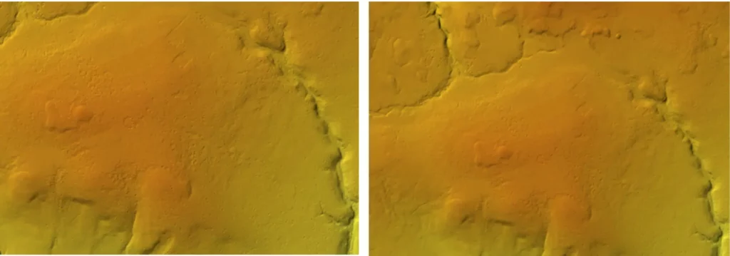
This site we are using as an example for this blog has been utilised by the British Armed Forces since the early 20th century. Large parts of the site are littered with craters, largely due to artillery and aircraft activities. LiDAR allows us to not only confirm craters observed in aerial photography but also discover previously hidden ones.
Upon close inspection, the high-resolution LiDAR image reveals numerous craters within the ‘Danger Area.’ These craters are remnants of artillery firing, dating back to before WWI. Additionally, modern bombing targets, like a SAM site (Surface-to-Air Missile), are located to the south, offering insights into historical military activities. These insights enable our team to identify potential UXO contamination in the area.

Revealing a moving target rail
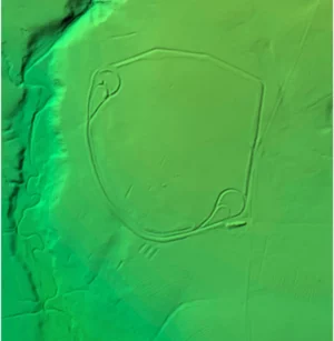
This LiDAR imagery paints a vivid picture of a moving target rail, predominantly used for training with anti-tank weaponry. The full extent of the rail and the scrapes caused by anti-tank ordnance are clearly visible. These rails were ideal for training military personnel to improve the accuracy of shooting a moving target.
This particular range was in use from at least WWII, with evidence indicating the use of WWII-era ordnance including QF 2-pounders, 6-pounders and 17-pounders, as well as post-WWII era weaponry such as the MOBAT and NLAW.

Unearthing trench networks
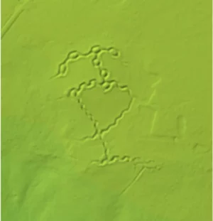
In addition to identifying craters, LiDAR imagery can clearly define areas of excavation, such as trenches, allowing us to build a greater understanding of how and where troops utilised this training area.
The trench network displayed below is clearly visible within LiDAR imagery, enabling a detailed analysis of the area. These particular trenches were excavated during WWI and were likely used for training purposes by both artillery and infantry units.

Locating firing points and development areas
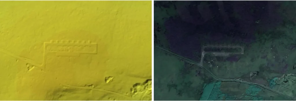
Finally, LiDAR imagery can also clearly define areas of development, such as old firing points, as displayed below.
This allows our team to build a greater understanding of how and where troops utilised this training area. Establishing where troops set up firing positions enables Brimstone to potentially identify where UXO may have been disposed of, or where firing templates may have oriented.

Determining risk levels
As you can see, the LiDAR imagery for this site enables our research team to draw a wide range of information which is essential in determining the level of UXO risk on site and the types of contamination that could be encountered.
The close attention to detail and extensive analysis provides a more granular look at UXO risk mitigation options for our clients. It also enables the zoning of sites, as it may indicate that some areas have higher risks than others!
Our UXO Risk Assessment service
If you’re in charge of a project that involves groundworks, be it humanitarian, governmental, or commercial, you need to consider the possibility of there being buried UXO onsite.
Assessing the UXO risk is the crucial first step in your UXO risk management plan. For a quick and cost-effective initial assessment, our Stage 1 Preliminary UXO Risk Assessment with a 24-hour turnaround is your solution. However, if your site has a military history, a Stage 2 Detailed UXO Risk Assessment is essential.
With your project scope in mind, our experienced Research team will create a bespoke UXO report, complete with actionable recommendations, aligning perfectly with your project’s scope.
Get in touch with Brimstone
If you’re embarking on a new project and need help determining which UXO risk assessment is right for your site, don’t hesitate to contact our Commercial team.
You can keep up to date with Brimstone by following us on Facebook, Instagram, X (formerly known as Twitter), LinkedIn and YouTube.